
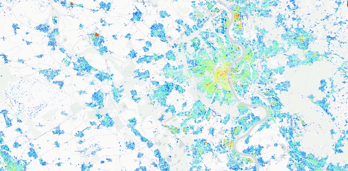
Building Height Map (DE)
Urban areas and especially the different heights of buildings have diverse and far-reaching effects on the environment. This product was generated by the 'Humboldt-Universität zu Berlin'and shows the building heights for the whole of Germany with a spatial resolution of 10m and a statistical accuracy of 2.9 to 3.5m (Frequency weighted RMSE).
The average building height varies considerably in Germany, with lower buildings in eastern and southeastern Germany and higher buildings along highly urbanized areas in western Germany.
The product Building Heights (DE) is based on time series of Sentinel-1A/B and Sentinel-2A/B data. As reference data several freely and openly available 3D building models are used, which originate from official data sources (building ground plan: cadastre, building height: airborne laser scanning).
The building height was only determined for built-up areas (European Settlement Mask). Building heights below 2 meters were set to 0. Detailed information on the background, methodology and precision of the data sets provided can be found in the reference literature below.
Legend for viewing in EO browser
- Dark blue: lower than 2m
- Light blue: 2m - 15m
- Green/Yellow: 15m - 30m
- Red: higher than 30m
Availability
- Germany: Complete coverage
- Europe: -
- Global: -
Updates
- n/a
Access
Depending on the environment and the intended use, there are several ways to access the data:
- EO Browser:
- CODE-DE Community Contributions --> Building Height Map (GE)
- Data Explorer: -
- Path to repository on a Virtual Machine:
- /codede/community/building-height-germany
Acknowledgement
- The dataset was generated by the 'Humboldt-Universität zu Berlin' and has received funding from the European Research Council (ERC) under the European Union's Horizon 2020 research and innovation programme (MAT_STOCKS, grant agreement No 741950).
- The dataset was generated by FORCE v. 3.1, which is freely available software under the terms of the GNU General Public License v.3 (or higher).
- Sentinel imagery were obtained from the European Space Agency and the European Commission.
- The European Settlement Mask was obtained from the European Commission.
- 3D building models were obtained from Berlin Partner für Wirtschaft und Technologie GmbH, Freie und Hansestadt Hamburg / Landesbetrieb Geoinformation und Vermessung, Landeshauptstadt Potsdam, Bezirksregierung Köln / Geobasis NRW, and Kompetenzzentrum Geodateninfrastruktur Thüringen.
- This dataset was partly produced on EODC - we thank Clement Atzberger for supporting the generation of this dataset by sharing disc space on EODC.
References
- Frantz, D., Schug, F., Okujeni, A., Navacchi, C., Wagner, W., van der Linden, S., Hostert, P. (2021). National-scale mapping of building height using Sentinel-1 and Sentinel-2 time series. Remote Sensing of Environment, 252, 112128. DOI: https://doi.org/10.1016/j.rse.2020.112128




