
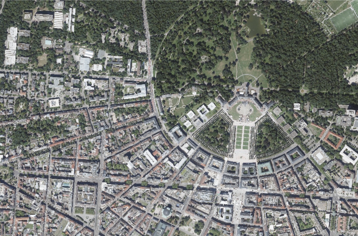
Digital Orthophotos - BW DOP20
Orthophotos are high-resolution, distortion-free, true-to-scale photographic images of the earth's surface. The fully digital production process results in digital orthophotos (true DOP) at the end of the process chain, which are characterised by the elimination of all perspective effects. This allows them to depict the landscape without distortion, enabling accurate spatial mapping. These characteristics make orthophotos ideal for use in geographic information systems (GIS), where they can be linked and overlaid with map material or other specialist data such as infrastructure plans or environmental information. They thus provide an important basis for analysis, planning, and documentation in many areas.
Statewide aerial surveys of Baden-Württemberg have been conducted since 1968. The aerial surveys are carried out in the summer in a two-year cycle and provide a ground sample distance (GSD) of 20 cm.
The digital orthophotos are available for Baden-Württemberg.
The available image material has the following characteristics:
- Spatial coverage: Baden-Württemberg
- Recording date: 2024
- Geometric resolution (ground resolution): 20 cm
- Reference system: EPSG:25832 - ETRS89 / UTM zone 32N
- File format: GeoTIFF (Cloud Optimized GeoTIFF, COG)
- Tiling / sheet section: 1 x 1 km
- Channels: True-colour RGBI (4 Channels in red, green, blue and near infrared)
Overviews of the sheet section can be found in the orthophotos folder under ‘extents.gpkg’.
Usage requirements
- Registration on CODE-DE: yes
- Cloud resources on CODE-DE: yes
- Individual request: yes (to establish access)
Data access
This data is available on individual request. Please create a support ticket to request the access instructions and credentials.
More information
More information can be found here on these external sources, among others:
- https://www.lgl-bw.de/Produkte/Luftbildprodukte/DOP20/
- https://opengeodata.lgl-bw.de/#/(sidenav:product/dop20)
Please send suggestions, comments and questions directly to geodaten@lgl.bwl.de.
Terms of usage
Any commercial and non-commercial use of the digital orthophotos offered is permitted.
The attribution must be made in the following manner: “Data source: LGL, www.lgl-bw.de, dl-de/by-2-0”.
The following license applies: Data License Germany - Attribution - Version 2.0 https://www.govdata.de/dl-de/by-2-0. By exercising a right granted by this license, you agree to be legally bound by these license terms, the following additions to the license, and the liability provisions.




