
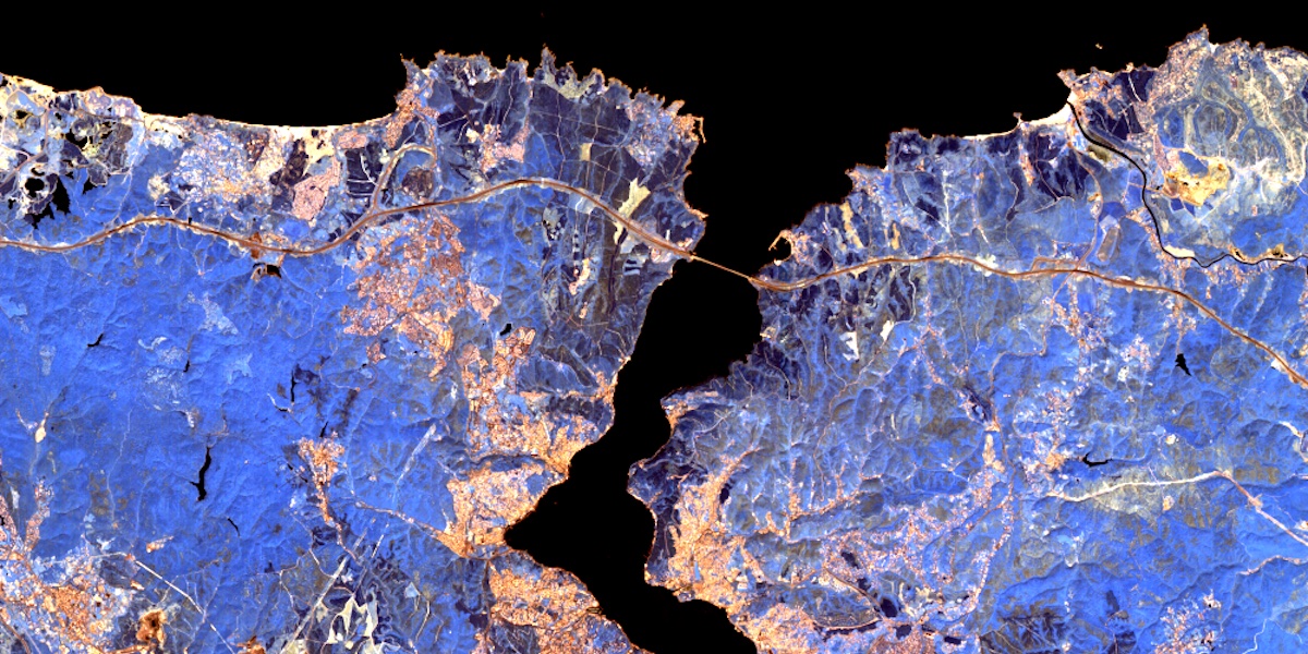
EnMAP - EnMAP L2A HSI
The Environmental Mapping and Analysis Program (EnMAP) is a German hyperspectral satellite mission to monitor and characterize Earth’s environment on a global scale. EnMAP allows to measure and model key dynamic processes of Earth’s ecosystems by extracting geochemical, biochemical and biophysical parameters that provide information on the status and evolution of various terrestrial and aquatic ecosystems. EnMAP provides unique data needed to address major environmental challenges related to human activity and climate change. The mission’s main objective is to study and decipher coupled environmental processes and to assist and promote the sustainable management of Earth’s resources. Despite being a primarily scientific mission, EnMAP has a clear potential to evolve towards operational services. Programming of new acquisitions is currently only possible for scientific purposes. For access guidelines to archived EnMAP data or acquisition requests, as well as general news, please visit the mission homepage at www.enmap.org .
The Level 2A processor converts radiometrically calibrated Level 1C products to surface reflectances using two different approaches for land and water applications. This split procedure is quite unique in data processing and should give the user the possibility to select the best result according to the area of interest (land or water or combined). The atmospheric correction involves generation of sun glint maps for water surfaces by identification of specular reflections, detection (and correction) of haze and cirrus, estimation of aerosol optical thickness and columnar water vapor and retrieval of surface reflectance after adjacency correction. Auxiliary data for further processing are attached to the output datasets, but not applied. Most applications are envisioned to use the Level 2A product for further analysis.
Usage requirements
| Required? | Remark | |
| Registration on EO-Lab | Yes | --- |
| Organisation on EO-Lab | Yes | --- |
| Cloud resources on EO-Lab | No | --- |
| Individual request | No | --- |
Accessing EnMAP data
EnMAP data are available for registered EO-Lab users.
Please make sure that an organisation including address is created in your user profile, otherwise the required security checks cannot take place and you will be denied access. You can create such an organisation in the profile manager in your EO-Lab account (top right corner of the website > click on your username > click on "profile").
Through identity federation with DLR EOC Geoservice, the EO-Lab user credentials can be used to download EnMAP assets from the EOC Geoservice (i.e. the data are not directly available on the EO-Lab platform).
-
In the Data Explorer, registered EO-Lab users can browse through EnMAP data by selecting the EO-Lab data catalogue, selecting "To Order" under "Availability" (because the data are hosted on an external source) and submitting a respective search query in the GUI. After product selection, the link will re-direct the user to the download page on the DLR EOC Geoservice, where all the assets of the selected scene can be downloaded.
-
A STAC-compliant catalogue holding the EnMAP collection is available for EO-Lab users under https://datahub.eo-lab.org/stac/collections/ENMAP .
Please note: before a user is able to download EnMAP data, they have to successfully authenticate via the EO-Lab IdP. Afterwards, the EOC User Management System (UMS) will ask the EO-Lab user to accept the „Acceptable Use Policy and Conditions of Use“ (AUP) and the according licence contract. Only after acceptance, the user will be authorised to access the requested data.
We provide a Jupyter Notebook within our samples in JupyterLab which will show you how to download data programmatically.
Terms of use
Links and references
Further information on EnMAP in general, the product specifications and the processor used to process all the data in the collection can be found on the following pages and documents:
[1] https://download.geoservice.dlr.de/ENMAP/files/
[2] https://geoservice.dlr.de/eoc/ogc/stac/v1/
[3] https://geoservice.dlr.de/eoc/ogc/stac/v1/collections/ENMAP_HSI_L2A
[4] https://pystac-client.readthedocs.io/en/stable/
[5] https://sso.eoc.dlr.de/enmap-download/selfservice
[6] https://sso.eoc.dlr.de/enmap-download/selfservice/public/newuser
[7] https://www.enmap.org/
[8] https://www.enmap.org/data/doc/EN-PCV-ICD-2009-2_HSI_Product_Specification_Level1_Level2.pdf
[9] https://www.enmap.org/data/doc/EN-PCV-TN-6007_Level_2A_Processor_Atmospheric_Correction_Land.pdf
[10] https://www.mdpi.com/2072-4292/13/22/453




