
FORCE DataCube Collection
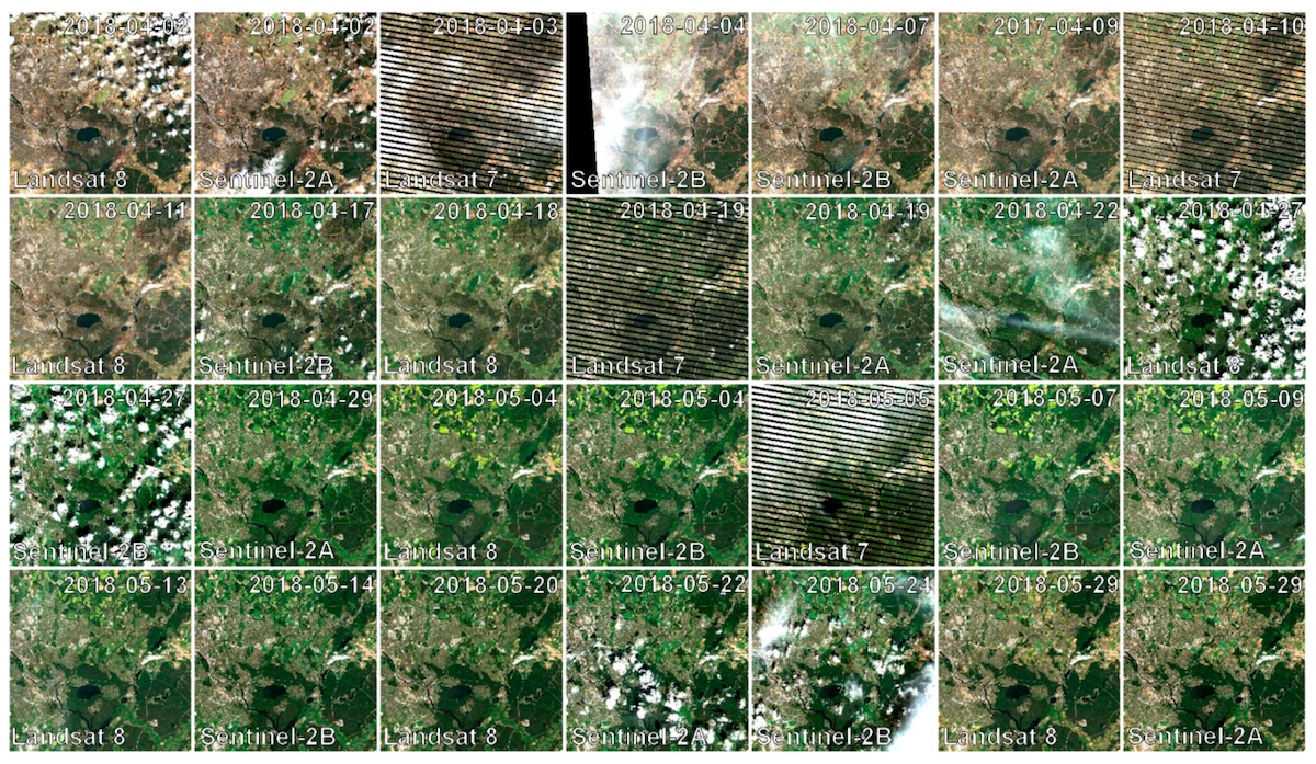
The FORCE DataCube holds a collection of analysis-ready Landsat and Sentinel-2 data. The multi-spectral optical imagery have a spatial resolution of 10m to 30m and are available for Germany from 1984 to today. It can, for example, be used to monitor the status of and processes on the Earth’s surface.
This data cube has been successfully used in a number of scientific studies (e.g. Kowalski et al. 2020, Schug et al. 2020, Frantz et al. 2021, Hemmerling et al. 2021) and is now available.
Details
The FORCE DataCube Collection provides Level 2 Analysis Ready Data from the Landsat 4-8 and Copernicus Sentinel-2 A/B image archives, i.e. from 1984 to today, for Germany, with a spatial resolution of 10m to 30m. Analysis Ready Data are harmonized, standardized, geometrically and radiometrically consistent data with per-pixel quality information. The data were generated by the Framework for Operational Radiometric Correction for Environmental monitoring (FORCE), a well-established tool to process Earth Observation image archives.
Additionally, a routine processing generates monthly Sentinel-2 composites with 10m spatial resolution, as well as combined Sentinel-2 + Landsat 8/9 with 30m. Processing is performed at the start of each month, generating the Sentinel-2 composite for the foregoing month, as well as the combined composite for the month before that (reflecting latency of image delivery).
The data are available from the virtual machines. They can be analyzed with any suitable processing software, GIS, or programming language. In addition, the data can be further analyzed using the Higher Level Processing System of FORCE. FORCE provides an encompassing toolset that can perform all essential tasks in a typical Earth Observation Analysis workflow, i.e. going from data to information. That includes, for example, machine learning classification and regression, time series and change analysis, image compositing, or data transformation. The links to the tutorials can be found below. FORCE is open source software and is available to all users via a virtual machine. Please see Help/FAQ page for installation instructions. Knowledge-based articles describe the data cube in depth, and demonstrate the usage of FORCE on the platform.
Data
Observations of the following sensor types are included in the FORCE DataCube:
- Landsat 4 Thematic Mapper, Collection 2
- Landsat 5 Thematic Mapper, Collection 2
- Landsat 7 Enhanced Thematic Mapper +, Collection 2
- Landsat 8 Operational Land Imager 2
- Landsat 9
- Sentinel-2 A MultiSpectral Instrument
- Sentinel-2 B MultiSpectral Instrument
- Sentinel-2 monthly composites
- Sentinel-2 + Landsat 8/9 monthly composites
All image acquisitions with cloud cover of less than 70% (according to the ESA/USGS metadata) were considered for the data cube. Image acquisitions for which FORCE’s internal cloud masking algorithm determined a cloud coverage over 90% were discarded. Similarly, image chips (30 x 30km) with more than 90% cloud coverage are not included in the FORCE DataCube. Only Tier 1 image acquisitions from Landsat are included. The Sentinel-2 data were co-registered with Landsat. Images were discarded if the co-registration failed (this mostly happens due to high cloud coverage).
Pre-processing
The pre-processing of the data includes:
- Advanced cloud and cloud shadow detection and consequent cloud masking
- Quality screening
- Integrated atmospheric and topographic correction
- Adjacency effect correction
- Bidirectional Reflectance Distribution Function (BRDF) correction
- Resolution merge of Sentinel-2 bands from 20m to 10m
- Co-registration of Sentinel-2 images
- Data cubing, i.e. reprojection and gridding
FORCE has been rigorously validated in a number of internal and external efforts, most prominently in the Atmospheric Correction Intercomparison eXercise (ACIX, Doxani et al. 2018), as well as in ACIX II (publication in preparation) and the Cloud Masking Intercomparison eXercise (publication in review).
Data Availability, Data Format, and Data Access
The data are available for Germany from 1984 to today. All pre-processed acquisitions are available as GeoTiff images in a tiled format, with a tile size of 30 x 30 km. Please consult the tutorial for further information about data structure and attributes.
The FORCE DataCube can be accessed through VMs or also directly in an instance of the CODE-DE JupyterLab. New image acquisitions will be continuously ingested into this dataset. Find additional information about how to access the DataCube here in our knowledgebase. Furthermore, our samples directory on Github includes templates for how to work with FORCE data.
The data can be further analysed using the FORCE processor. This requires the user to set up a docker installation of FORCE on a virtual machine. Please see the FAQs and tutorials following the links below.
Usage requirements
There are certain requirements that must be met for use. Some data or services require an individual application. For more information, please contact CODE-DE Support.
| Required? | Remark | |
| Registration on CODE-DE | Yes | --- |
| Cloud resources on CODE-DE | Yes | --- |
| Individual request | No | --- |
More information
Further information on this product can also be found on the following external pages:
- FORCE - Key Publication
- FORCE - ResearchGate
- FORCE - Documentation
- FORCE - Tutorials
- Docker Documentation
- Github - FORCE code
- Github - CODE-DE - FORCE
- Technical facts - Landsat 4
- Technical facts - Landsat 5
- Technical facts - Landsat 7
- Technical facts - Landsat 8
- Technical facts - Landsat 9
- Technical facts - Sentinel-2
References
The Framework for Operational Radiometric Correction for Environmental monitoring (FORCE) was developed by David Frantz.
- Frantz, D. (2019): FORCE – Landsat + Sentinel-2 Analysis Ready Data and beyond. Remote Sensing 11, 1124, doi: 10.3390/rs11091124
- Doxani, G., Vermote, E., Roger, J.-C., Gascon, F., Adriaensen, S., Frantz, D., Hagolle, O., Hollstein, A., Kirches, G., Li, F., Louis, J., Mangin, A., Pahlevan, N., Pflug, B., & Vanhellemont, Q. (2018). Atmospheric Correction Inter-Comparison Exercise. Remote Sensing, 10, 352, doi: 10.3390/rs10020352
- Frantz, D., Schug, F., Okujeni, A., Navacchi, C., Wagner, W., van der Linden, S., & Hostert, P. (2021). National-scale mapping of building height using Sentinel-1 and Sentinel-2 time series. Remote Sensing of Environment, 252, 112128, doi: 10.1016/j.rse.2020.112128
- Hemmerling, J., Pflugmacher, D., Hostert, P., (2021). Mapping temperate forest tree species using dense Sentinel-2 time series. Remote Sensing of Environment, 267, 112743, doi: 10.1016/j.rse.2021.112743
- Schug, F., Frantz, D., Okujeni, A., van der Linden, S., & Hostert, P. (2020). Mapping urban-rural gradients of settlements and vegetation at national scale using Sentinel-2 spectral-temporal metrics and regression-based unmixing with synthetic training data. Remote Sensing of Environment, 246, 111810. DOI:10.1016/j.rse.2020.111810
- Kowalski, K., Senf, C., Hostert, P., & Pflugmacher, D. (2020). Characterizing spring phenology of temperate broadleaf forests using Landsat and Sentinel-2 time series. International Journal of Applied Earth Observation and Geoinformation, 92, 102172. DOI:10.1016/j.jag.2020.102172
Terms of use
Use of the product is subject to the following terms of use:




