
incora – Settlement Monitoring
The rapidly changing settlement structures can be recorded with Copernicus satellite data.
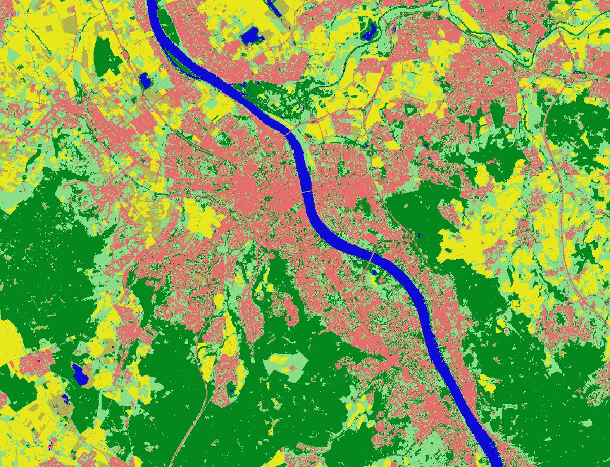
In the incora project, annual Germany-wide land cover classifications are created to consistently record the status of and changes in settlement and transport areas. "Together with our partners ILS Dortmund and BBSR, we are thus able to calculate indicators of land consumption and make them available for decisions in spatial planning," says Dr. Markus Neteler of mundialis GmbH & Co. KG. The basic land cover classifications were calculated based on Sentinel-2 data using fully automated training data generation in the cloud and are now made available on CODE-DE. The incora project is supported by the BMDV (former BMVI) as part of the mFUND initiative.
Our approach is based on cloud-free temporal mosaics created by the MAJA/WASP processors. An automatic procedure to derive training areas is implemented using the geoprocessing platform actinia. High accuracy results are achieved, but they depend on the availability of cloud-free Sentinel-2 input data covering different seasons.
Apart from imagery data, several auxiliary datasets are used to generate sets of training and validation data:
- OpenStreetMap (OSM): water, buildings and roads, rasterized to a common 10 meter grid.
- Copernicus HRL Imperviousness Status Map 2018: Raster containing sealing density from 0-100% at 10 meter resolution.
- S2GLC Land Cover Map of Europe 2017: Sentinel-2 based land cover classification consisting of 13 land cover classes with 86% overall accuracy.
Sentinel-2 spectral band and index statistics as well as auxiliary datasets are used to define rules for automated training set generation for the six target classes: forest, low vegetation, water, built-up area, bare soil and agricultural land. The training pixels are then fed into a Random Forest classifier together with the Sentinel-2 indices (including temporal NDVI statistics) and spectral bands B02, B03, B04, B06, B08, B11 and B12 to perform the classification.
Based on the German-wide classifications of 2016 and 2019 a map is derived that contains all possible combinations of land cover change. A spatial filter is applied to eliminate isolated change pixels and edge effects.
To get a detailed description of the developed method download the paper published at the BIDS'21 Conference.
Availability
- Germany: full coverage 2016/2019/2020
- Europe: -
- Global: -
Updates
- -
Access
Depending on the environment and the intended use, there are several ways to access the data:
- EO Browser: Community Contributions --> incora
- Data Explorer: -
- Path to repository on a Virtual Machine: /codede/community/incora
Reference
- Riembauer, G., Weinmann, A., Xu, S., Eichfuss, S., Eberz, C., Neteler, M. (2021): Germany-wide Sentinel-2 based land cover classification and change detection for settlement and infrastructure monitoring. Proc. of the 2021 conference on Big Data from Space, Soille, P., Loekken, S. and Albani, S., eds., EUR 30697EN, Publications Office of the European Union, Luxembourg, 2021, ISBN 978-92-76-37661-3, JRC125131, pp.53-56, https://doi.org/10.2760/125905




