
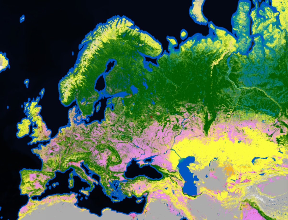
Land - ESA WorldCover
ESA WorldCover provides a new baseline global land cover product at 10 m resolution for the year 2020 based on Sentinel-1 and 2 data that was developed and validated in almost near-real time and at the same time maximizes the impact and uptake for the end users.
Monitoring global land cover changes is essential in managing the Earth's natural capital such as soils, forests, water resources and biodiversity. Given the changing state of this natural capital, the need for timely, accurate and high resolution land cover information is more pressing than ever.
The European Space Agency initiated the WorldCover project to provide a new global baseline land cover product for 2020 with the following characteristics:
- Validated global land cover map at 10 m resolution
- Including 11 land cover classes
- Overall accuracy of 75 %
- Based on Copernicus Sentinel-1 & Sentinel-2 data
- Fulfilling the requirements of UNCCD, WRI, CIFOR, FAO & OECD as key users
The WorldCover map is available free of charge to the entire community. The map contains 11 different land cover classes at 10 m resolution. From cropland or grassland to permanent water bodies over built up areas and much more. The WorldCover map is valuable for a diverse set of users active in e.g. agriculture, biodiversity & nature conservation, land use planning, natural capital accounting, as well as climate change. Compared to the initial prototype an additional mangrove class was added because of the importance of this class as a carbon sink.
Availability
- Germany: 2020
- Europe: 2020
- Global: 2020
Usage requirements
There are certain requirements that must be met for use. Some data or services require an individual application. For more information, please contact CODE-DE Support.
| Required? | Remark | |
| Registration on CODE-DE | No | --- |
| Cloud resources on CODE-DE | No | --- |
| Individual request | No | --- |
Access
Depending on the environment and the intended use, there are several ways to access the data:
- EO Browser: Copernicus Services --> Landüberwachung - ESA WorldCover
- Data Explorer: -
- Path to repository on a Virtual Machine:
- /codede/auxdata/esa-worldcover-2020
More information
Further information on this product can also be found on the following external pages:




