
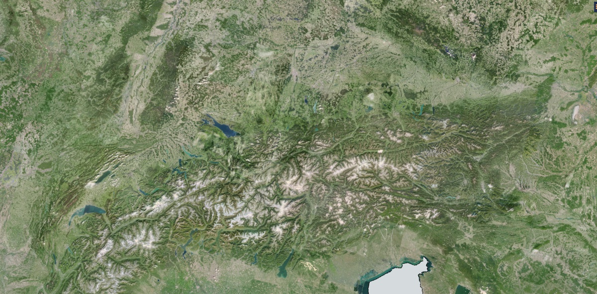
Land - VHR Mosaic
The very high resolution image mosaics are part of the pan-European component of Copernicus Land Monitoring Services (CLMS), managed by the European Environment Agency (EEA). The mosaics serve as input for the creation of many of the Copernicus information products and services, such as land cover maps and high resolution layers on land cover characteristics.
The mosaics are, for example, useful to detect differences in areas with large local variation e.g. urban areas.
High Resolution satellite imagery forms the input for the creation of many information products and services, such as land cover maps or high resolution layers on land cover characteristics. Having all the satellite imagery available for the desired area, it is worthwhile to process the individual image scenes into a seamless pan-European ortho-rectified mosaic.
Since 2012 the European Commission has tasked the European Space Agency (ESA) with the systematic acquisition of seamless European-wide coverage of satellite images approximately every three years. This time series of high resolution image mosaics provides the basis for underpinning and monitoring of Community policies.
The creation of such mosaics involves various processing steps such as radiometric smoothening between scenes from different dates and sensors, geometric correction to ortho-rectified products and minimizing cloud cover.
The 2012 mosaic provides optical coverage over Europe - including the Riparian zones - to cover the requirements of various Copernicus Services:
- Land applications at European and national level - Examples are the Urban Atlas, Natura 2000 sites and the EU-hydro data set
- The emergency response service uses the dataset to have a continuous update of the image archive for reference mapping
The surface covered by the image dataset is 7.3 million square kilometers and has a spatial resolution of 2.5 meters. The acquisition window of the imagery is January 2011 to December 2013. Images are derived from the following satellite sensors:
- SPOT-5 at 2.5m pan-sharpened
- SPOT-6 at 1.5 m pan-sharpened
- FORMOSAT-2 at 2m pan-sharpened
The VHR 2018 mosaic dataset provides one cloud-free VHR optical coverage of 39 European States (EEA-39) including all islands of those countries acquired within predefined windows corresponding to the vegetation season in 2017-2018-2019. Spatial resolution of the dataset is 2 meters.
The input data consists of a mix of Pleiades, SPOT, DOVE, Kompsat-4, Deimos-2, SuperView, and TripleSat images. The input imagery has been color balanced against the Sentinel-2 based HR mosaic from 2018. Color balancing is done through iterative histogram matching, where the first iteration is used to identify clouds and snow, and the second iteration re-balances, with the bright objects masked out.
Availability
- Germany: 2012, 2018
- Europe: 2012, 2018
- Global: -
Usage requirements
There are certain requirements that must be met for use. Some data or services require an individual application. For more information, please contact CODE-DE Support.
| Required? | Remark | |
| Registration on CODE-DE | No | --- |
| Cloud resources on CODE-DE | No | --- |
| Individual request | No | --- |
Access
Depending on the environment and the intended use, there are several ways to access the data:
- EO Browser: Copernicus Services --> Land - VHR Mosaic
- Data Explorer: -
- Path to repository on a Virtual Machine: -
More information
Further information on this product can also be found on the following external pages:
Terms of use
Use of the product is subject to the following terms of use:




