
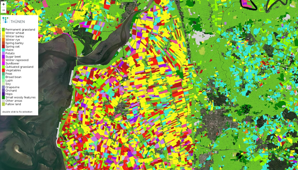
National maps of agricultural land use (DE)
The Agricultural Land Use dataset contains maps of the main classes of agricultural land use (dominant crop types and other land use types) in Germany, which have been produced annually at the Thünen Institute since 2017 on the basis of satellite data. The maps cover the entire open landscape, i.e. the agriculturally used area (UAA) and e.g. uncultivated areas. The map was derived from dense time series of Sentinel-1, Sentinel-2, Landsat 8 and additional environmental data. Map production is based on the methods described in Blickensdörfer et al. (2022).
The map extent covers all areas in Germany that are defined as agricultural land, small woody features, heathland or peatland according to ATKIS Basis-DLM 2020 (Geobasisdaten: © GeoBasis-DE / BKG (2020)). Post-processing of the maps included a sieve filter as well as a ruleset for the reduction of non-plausible areas using the Basis-DLM. The final post-processing step comprises the aggregation of the gridded data to homogeneous objects (fields) based on the approach that is described in Tetteh et al. (2021).
Data are available either in raster format (cloud-optimized geoTIFF) or in vector format (FlatGeobuf). For metadata details please see the specifications below.
Availability
- Germany: Complete coverage
- Europe: -
- Global: -
Updates
- n/a
Access
These data are open and available for everyone on CODE-DE. Please create a support ticket to get the access information!
More information
Further information on this product can also be found on the following external pages:
- https://zenodo.org/records/10640528 (raster data)
- https://zenodo.org/records/10619783 (vector data)
References
The following list of references does not claim to be exhaustive, but it does provide an initial introduction to more advanced specialised literature:
-
Blickensdörfer L, Schwieder M, Pflugmacher D, Nendel C, Erasmi S, Hostert P (2022) Mapping of crop types and crop sequences with combined time series of Sentinel-1, Sentinel-2 and Landsat 8 data for Germany. REMOTE SENSING OF ENVIRONMENT 269:112831. doi: 10.1016/j.rse.2021.112831
-
BKG, Bundesamt für Kartographie und Geodäsie (2015). Digitales Geländemodell Gitterweite 10 m. DGM10. https://sg.geodatenzentrum.de/web_public/gdz/dokumentation/deu/dgm10.pdf (last accessed: 19. August 2021).
-
BKG, Bundesamt für Kartographie und Geodäsie (2018). Digitales Basis-Landschaftsmodell.
-
https://sg.geodatenzentrum.de/web_public/gdz/dokumentation/deu/basis-dlm.pdf (last accessed: 19. August 2021).
-
Frantz, D. (2019). FORCE—Landsat + Sentinel-2 Analysis Ready Data and Beyond. Remote Sensing, 11, 1124.
-
Tetteh GO, Gocht A, Erasmi S, Schwieder M, Conrad C (2021) Evaluation of Sentinel-1 and Sentinel-2 Feature Sets for Delineating Agricultural Fields in Heterogeneous Landscapes. IEEE Access 9:116702-116719. doi: 10.1109/ACCESS.2021.3105903
Terms of Use
Use of the product is subject to the following terms of use:




