
OroraTech - Land Surface Temperature
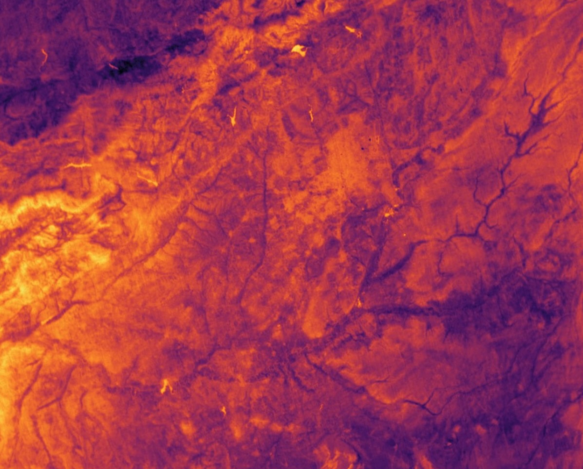
Cloud-free land surface temperature images derived from satellite images
OroraTech is a global intelligence-as-a-service company leveraging thermal data for a sustainable Earth. The company is establishing its own thermal satellite constellation, starting in 2023 with the first operational satellite FOREST-2 (overpasses every 1-2 days via tasking) and will expand in 2025 to provide several overpasses per day.
As part of the partnership between German Space Agency and OroraTech, scientific users can download land surface temperature images from the archive (data availability from April 2024) or request images of their own areas of interest at a certain time in the future (tasking).
Land surface temperature (LST) data has a number of valuable use cases, including monitoring urban heat patterns to support sustainable city planning, assessing forest and silviculture for health management and wildfire prevention, and observing crop irrigation to enhance agricultural productivity. By offering unprecedented access to real-time and historical thermal data, OroraTech empowers researchers to better understand and address critical environmental challenges.
This image material has the following characteristics:
- Size of image: 70.000 - 200.000 km²
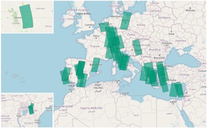
- Spatial coverage: archive data are distributed globally, main focus on Central Europe (see graph of data coverage; scene footprints are also provided)
- Data availability:
- archive data will be continuously updated (starting April 2024)
- User requests for individual scenes will be available from 2025 onwards
- Ground sample distance (nadir*):
- 200 m
- *The actual spatial resolution of the images varies depending on the pointing angle. Pointing nadir the ground sample distance is 200m.
- Reference system:
- WGS 84 (EPSG 4326)
- File format:
- GeoTiff for image data
- GeoJSON for specifying the geographical boundary of the image and other non-spatial attributes (for a better overview, there are overview files in the folders of the respective data)
Data coverage:
The following applies to the LST images:
LST derived from radiance measured by thermal infrared imagers at longwave-infrared (LWIR) band centred around 11.45 µm
Usage requirements
- Registration: yes
- Cloud resources: no
- Individual request: yes (to establish access)
Data access
These data are available for research projects and on request only - a specific approval workflow applies:
- Go to Tenant Manager, login.
- Make sure that your user profile is assigned to an "Organization". To check this, navigate to "Configuration" and "Organization". IMPORTANT: Before creating a new organisation, please check whether one has already been created for your employer or project. Please contact the administrator / person responsible for your project.
If in doubt, please send us a support request in advance! - After the assignment (or creation) of an Organization, a new option will appear in the menu on the left under "Support", called "Data application".
- Create a "Data application" (link in the left side menu) for the "Thermal Data". Fill out all the necessary input fields and submit your request. You will be notified after the evaluation.
- Once your application has been successfully processed, you will automatically be granted access to all available archived data at /eodata/ororatech.
More information
More information can be found here on these external sources, among others:




