
Sentinel-5P L2 AER
CODE-DE features two aerosol related products derived from TROPOMI measurements: TROPOMI Aerosol Layer Height (LH) and Aerosol Index (AI).
The TROPOMI Aerosol Layer Height (LH) product focuses on retrieval of vertically localized aerosol layers in the free troposphere, such as desert dust, biomass burning aerosol, or volcanic ash plumes in layers for cloud-free scenes. Applications include radiative forcing studies, long-range transport modeling and studies of cloud formation processes, and are of use for aviation safety. Retrieval of aerosol height is based on absorption in the O2 A band in the near-infrared wavelength range (759 and 770 nm). The TROPOMI LH processing utilizes based on neural network methodology.
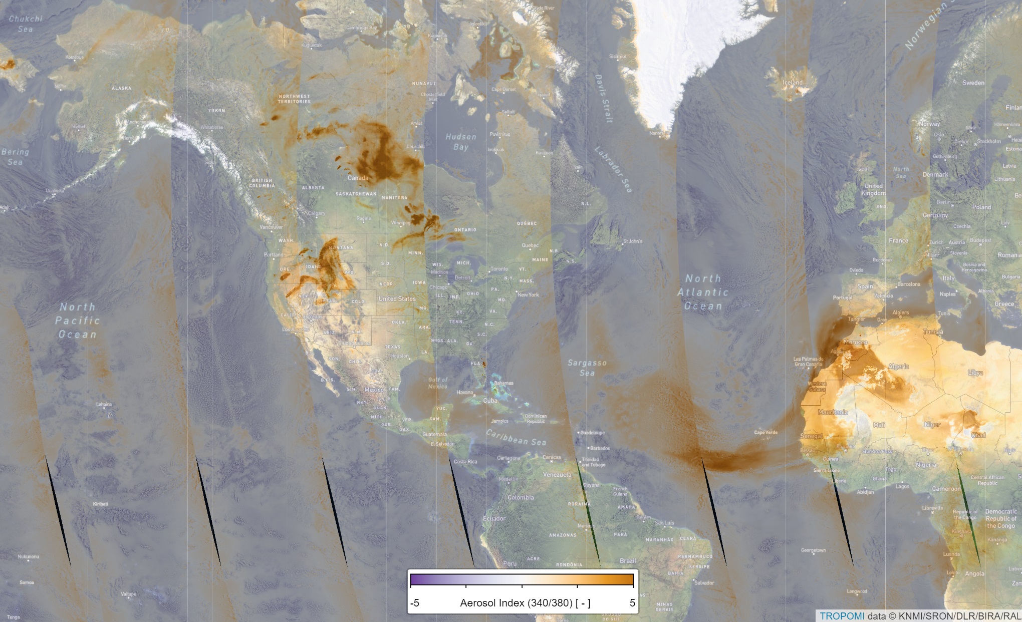
The Aerosol Index (AI) is a well-established data product that has been calculated for several different satellite instruments spanning a period of more than 40 years. The S5P/TROPOMI aerosol index is referred to as the Ultraviolet Aerosol Index (UVAI). The relatively simple calculation of the Aerosol Index is based on wavelength dependent changes in Rayleigh scattering in the UV spectral range where ozone absorption is very small. UVAI can also be calculated in the presence of clouds so that daily, global coverage is possible. The AI is ideal for tracking the evolution of episodic aerosol plumes from dust outbreaks, volcanic ash, and biomass burning.
The figure shows the S5P/TROPOMI UVAI (NRTI) on 10 July 2021, Saharan dust as well as biomass burning smoke plumes over the United States and Canada are most visible.
Availability
- Germany: 2018-04 - now
- Europe: 2018-04 - now
- Global: 2018-04 - now
Access
Depending on the environment and the intended use, there are several ways to access the data:
- EO Browser: Sentinel-5P L2 AER_AI
- Data Explorer:
- Data Catalogue: CODE-DE
- Path to repository on a Virtual Machine:
- /codede/Sentinel-5P/TROPOMI/L2__AER_AI
- /codede/Sentinel-5P/TROPOMI/L2__AER_LH




