
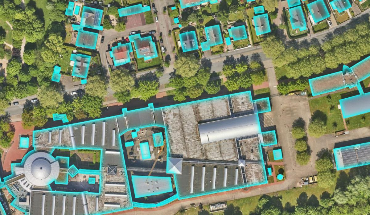
AI building recognition for updating the real estate cadastre
The State Office for Geoinformation and Surveying of Lower Saxony (LGLN) is developing AI models for recognising buildings in high-resolution aerial images. The models are trained using the CODE-DE cloud resources.
Goal of the project
The goal is to use CODE-DE to develop AI models that can be used throughout Germany - and in the long term throughout the EU - to recognise buildings in aerial images.
This further development will make it possible in future to capture buildings directly from aerial images and thus update the property register, 3D city models and digital twins faster and more reliably. AI building recognition thus forms the basis for a wide range of issues where a highly up-to-date digital building stock is required.
Use of CODE-DE
The use of CODE-DE is crucial to the success of AI building detection, as the platform provides powerful cloud resources:
- GPU resources for training the AI models
- Scalable cloud resources for applying AI models to large amounts of data
- Storage and provision of large amounts of data via S3 buckets
Results and added value
- AI building recognition has been in productive use in Lower Saxony's land registry offices since 2024. AI information on new buildings, extensions, demolitions and partial demolitions eliminates the need for tedious, manual screening and enables an efficient, digital process. The Generation 5.2 model trained on CODE-DE creates the basis for this.
- Other authorities can use AI building recognition as a software-as-a-service via the cloud service portal of the Deutsche Verwaltungscloud (DVC).1 This enables subsequent utilisation of the AI model and joint financing.
- In future, AI building recognition will replace the slow and resource-intensive manual recording of buildings from aerial images. This is also possible because future generations of AI models will be trained with even higher resolution aerial image data (GSD < 10 cm).
- The plan is to publish the building polygons recognised by the AI under an open data licence. This will enable them to be used by other authorities, science, industry or the open street map community. Sample data is already available.2




