Digi²Soil – Spatial modelling of soil parameters using machine learning
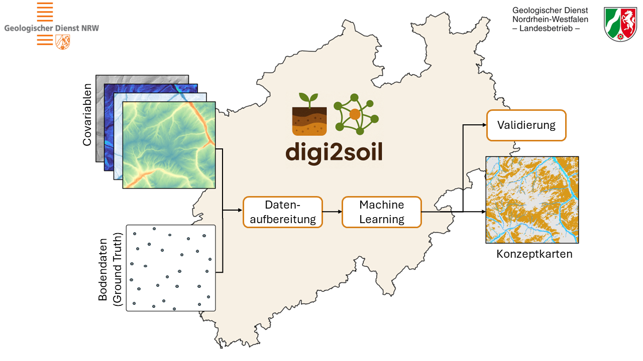
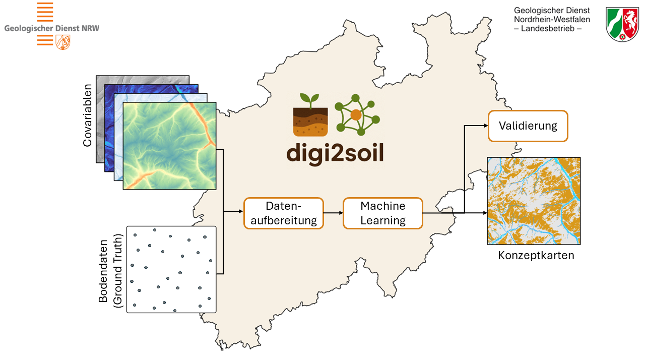
Digi²Soil is a project run by the Geological Survey of North Rhine-Westphalia aimed at the large-scale modelling, prediction and spatial analysis of selected soil parameters using Digital Soil Mapping (DSM) and machine learning techniques.
The objective of the project is to achieve a precise and efficient spatial mapping of soil properties by combining digitally recorded pedological core drilling data with remote sensing environmental predictors using modern data analysis and machine learning methods. The resulting outputs are intended to provide comprehensive soil information and can serve as a decision-making basis for forestry, agriculture, soil protection, and environmental planning. The initial focus is on modeling soil parameters for agriculturally and forest-utilized areas in the mountainous regions of North Rhine-Westphalia. Looking ahead, the developed methodology is planned to be transferred to additional regions and land use types. The project will run until 2029. Publication of the generated raster datasets of soil parameters as well as conceptual maps is planned.
CODE-DE-Lab serves as the central cloud-based working and development environment in the Digi²Soil project for processing and analyzing satellite data to model soil parameters. Data analysis is performed using R. A key advantage for the project is the availability of state-of-the-art preprocessed Level-2 satellite data directly on CODE-DE-Lab.
Use of CODE-DE-Lab in the Project
- Access to the FORCE DataCube Collection, with a particular focus on Sentinel-2 time series starting from 2019
- Generation of Best-Available-Pixel composites for the relevant years
- Calculation of relevant vegetation and soil indices, such as:
- NDVI (Normalized Difference Vegetation Index)
- EVI (Enhanced Vegetation Index)
- NDWI (Normalized Difference Water Index)
- BSI (Bare Soil Index)
- Extraction of raster values at the locations of pedological drilling points
- Training and validation of the Random Forest classifier