Object-based time-series analysis of Sentinel-2 Level 2 data via CREODIAS
The project was undertaken in a period of 6 months as a master thesis.
The University of Bonn that has undertaken this research as pre-study for the project WetlandHealth4UNGoals. This study explores whether combining Sentinel-2 time-series (2015-2024) of NDWI / NDVI combined with Planet NICFI object-based segmentation and DTW-k-means clustering can more precisely delineate and monitor small inland wetlands. Using Lake Baringo, Kenya, as a case study, it aims to refine spatio-temporal wetland mapping methods to better understand ecosystem dynamics amid rapid environmental change.
Small inland wetlands in semi-arid regions like Kenya’s Rift Valley are critical for ecosystem services but remain poorly monitored, despite increasing environmental pressures. This study supports the WetlandHealth4UNgoals project, a collaboration between ZFL and UNU-EHS, aimed at improving the monitoring and classification of wetlands using Earth observation data. The focus is on endorheic wetlands such as those around Lake Baringo, where contradictory hydrological trends call for more precise, time-series-based assessments. By integrating object-based image analysis and clustering methods, the study contributes to understanding wetland dynamics under climate and land-use change. The project also supports SDG and ecosystem service reporting while contributing to global frameworks like the UNFCCC and the Ramsar Convetion.
For the object based segmentation a workflow and data outside CODE-DE was developed and used before integrating it into the VM. Next, Sentinel-2 Level 2 data was downloaded to the personal VM using CREODIAS credentials and an additional storage volume of 5TB. Due to the data storage of the Sentinel 2 data in a complex directory system on the part of CREODIAS a download of the data was much easier than directly working with the data, however, this is critical regarding the growing database and higher storage volumes. As part of a master thesis, a validation of the data was undertaken partly within the VM and partly in qGIS.
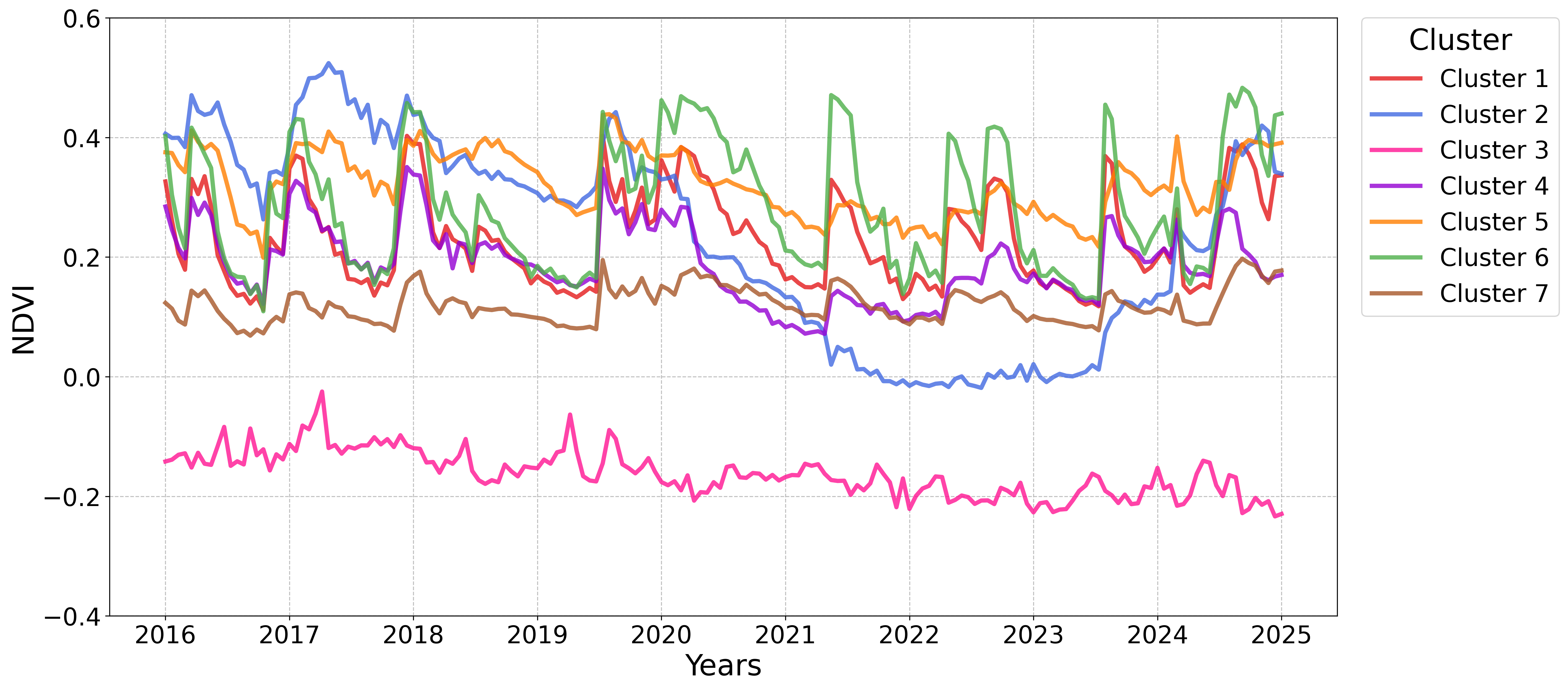
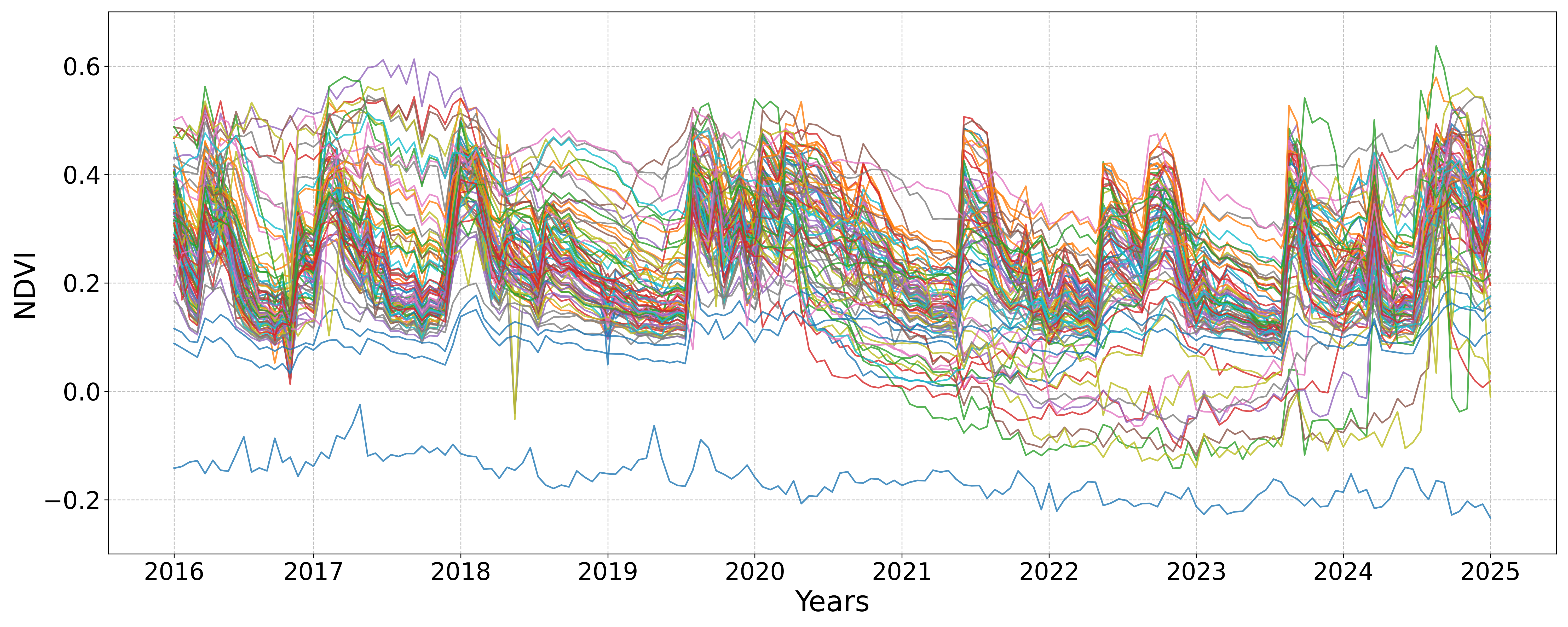
The data is used for the computation of time-series and clusters.
In the project, the CODE-DE platform was used to analyze Sentinel-2 time series (2015–2024) for monitoring small wetlands in the Rift Valley (Kenya). The cloud infrastructure enabled direct access to EO data as well as the execution of preprocessing, index calculations (NDVI/NDWI), and data-driven classification without the need for local downloads. By using virtual machines and Jupyter Notebooks, complex analyses could be carried out efficiently, transparently, and collaboratively. Key advantages included time savings, scalability, and the potential integration with SDG reporting frameworks. Minor limitations were related to the limited computing power of individual instances and the initial learning curve associated with the platform environment.