
Research project SAR4Infra
Landesamt für Vermessung und Geoinformation Schleswig-Holstein (LVermGeo SH)
Leibniz Universität Hannover, Institut für Photogrammetrie und GeoInformation (IPI)
Helmholtz-Zentrum Potsdam, Deutsches GeoForschungsZentrum (GFZ)
Landesbetrieb Straßenbau und Verkehr Schleswig-Holstein (LBV.SH)
Monitoring traffic infrastructure with Sentinel-1 radar data
Methodology
Radar interferometry is a technology that makes it possible to precisely record and monitor changes on the earth's surface. As part of the SAR4Infra research project, this technology is being used to monitor and analyse threats to the transport infrastructure in Schleswig-Holstein using Sentinel-1 (S1) data.
The Project
SAR4Infra is intended to enable the early detection of deformations in the transport infrastructure (roads, railways, bridges) by setting up an automated system. The aim is to prevent potential danger spots and ensure road safety. For efficient processing, the operational process chain is based on an open source software solution and integrated into the CODE-DE cloud environment, which already holds the required S1 data. The phase information of the S1 data is of interest here. Over a longer period of time, many phase images can be built up into an image stack and analysed. The phase differences between the individual recording times can be measured in so-called interferograms, and a long-term trend (subsidence, uplift or stable) can be determined with millimetre precision. The aim is to detect unusual ground movements at an early stage. The result is a risk assessment map for endangered infrastructure, which can be updated regularly and interactively as required in order to promptly detect dynamically developing damage for areas of interest. The results are to be made available via a web service.
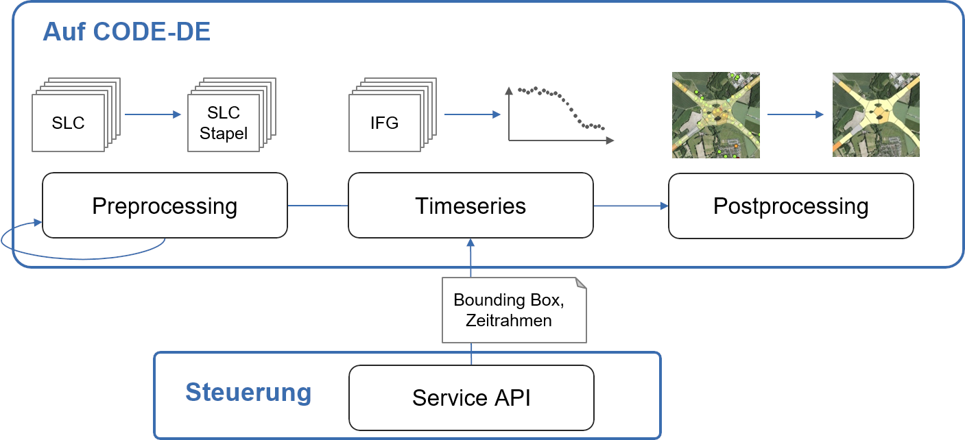
Figure 1: Overview of the three steps in the process chain. It is controlled by means of an API.
The developed process chain consists of three parts (Figure 1). Firstly, the available S1 data is co-registered and an image stack is created (preprocessing). In the next step, motion time series are derived for backscatterers with a good signal-to-noise ratio (timeseries). Finally, the backscatterers are intersected with the position of the traffic infrastructure and merged into polygons (post-processing). The result is then visualised in the LVermGeo.SH WebGIS and made available to users. New images are automatically added to the process chain. To this end, the new images are co-registered with the existing image stack and stored for time series analysis. An area with a time frame for the time series analysis can be selected interactively using an interface (API). The results are transferred via the interface after processing.
Persistent scatterer interferometry has proven to be a suitable method for analysing time series. In the project, existing time series methods were compared and adapted with regard to the transport infrastructure. Phase filtering was added to the methodology. The filtering is intended to increase the number of measurement points on the transport infrastructure. Even if the number of measurement points is not sufficient to cover the entire transport infrastructure (Figure 2), the developed methodology can be used to carry out a hazard assessment as a supplement to the usual field measurements.
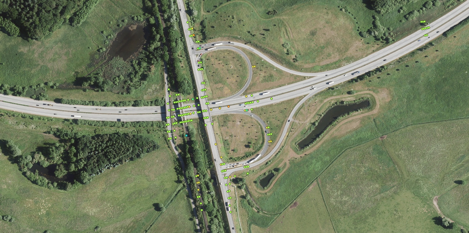
Figure 2: Evaluated backscatterers on a motorway bridge and carriageway. The point density depends on the respective signal-to-noise ratio of the backscatterers. Background DOP ©GeoBasis-DE/LVermGeo SH/CC-BY 4.0
Thanks to continuous updating and processing as required, SAR4Infra offers a risk assessment for transport infrastructure in Schleswig-Holstein that complements the German and European ground movement service.
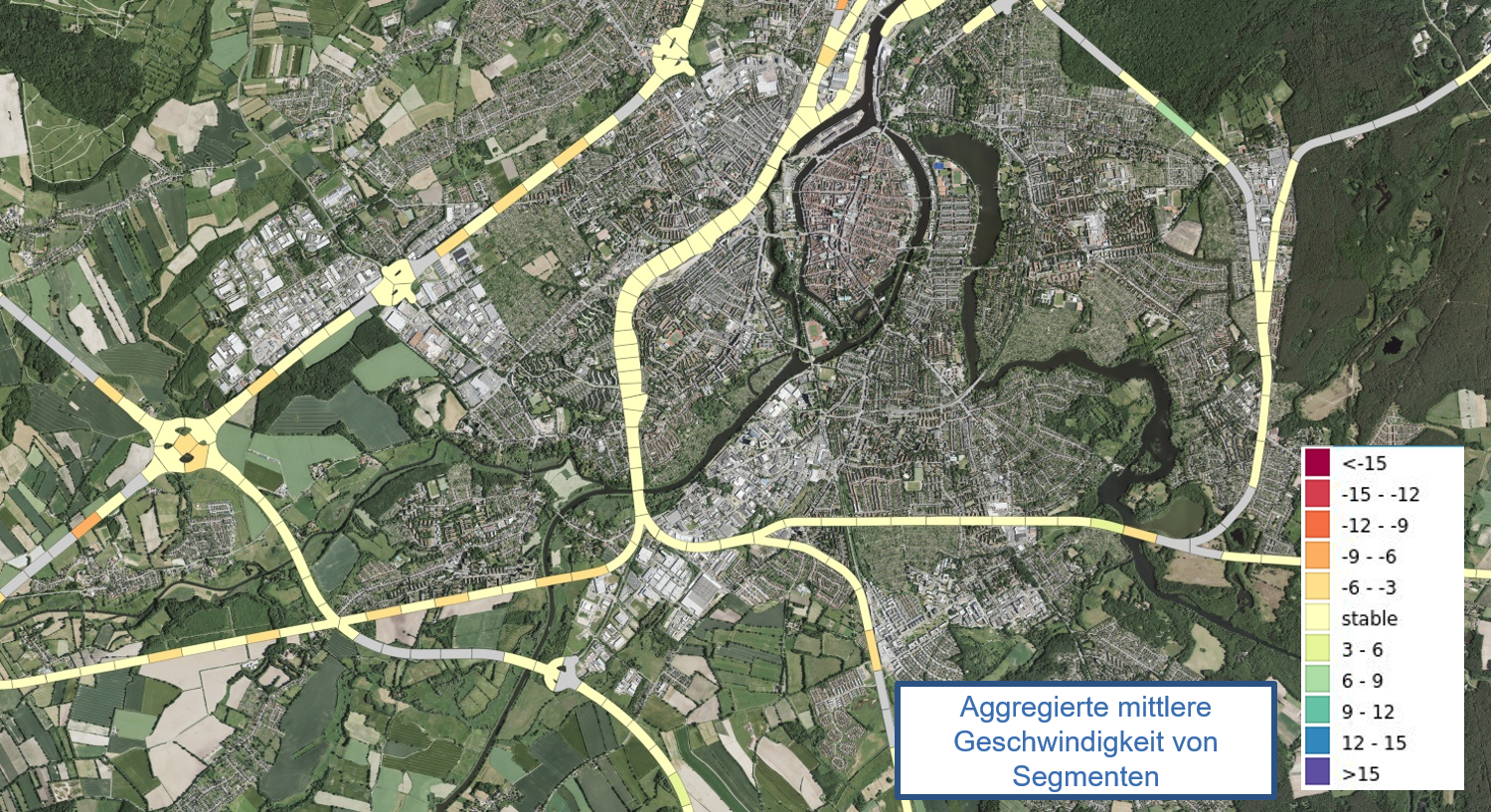
Figure 3: Segments of the transport infrastructure with their mean velocities. The measurement points outside the transport infrastructure are used to derive ground movements more robustly. Background DOP ©GeoBasis-DE/LVermGeo SH/CC-BY 4.0




