
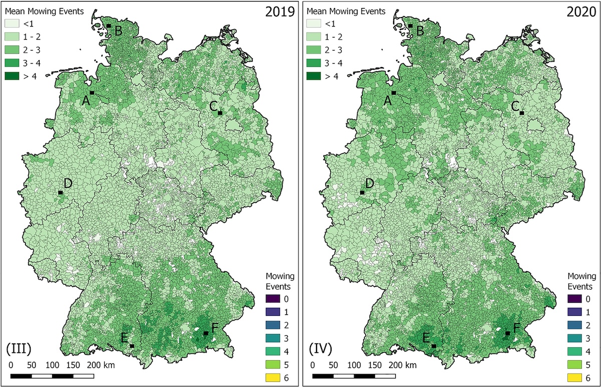
Grassland mowing events across Germany
Grasslands provide a wide range of ecosystem services within agricultural landscapes. Mapping and assessing the status and use intensity of grasslands is thus important for environmental monitoring. We here provide maps with detected mowing events, as a proxy for grassland use intensity, for grassland areas across Germany for the years 2017 to 2021.
The dataset contains maps of grassland mowing activity in Germany, which have been produced annually at the Thünen Institute beginning with the year 2017 on the basis of satellite data. The maps cover the entire grassland area, i.e. permanent grassland, potentially permanent grassland (e.g. fodder crops) and other extensive areas. They are derived from dense time series of Sentinel-2, Landsat 8 (and 9) data. Map production is based on the methods described in Schwieder et al. (2022). The algorithm used to derive the maps is available as a user-defined function for the FORCE environment (Frantz, D., 2019).
Each annual dataset includes seven layers: (1) the number of detected mowing events, (2) the day of year (DOY) of the first to sixth detected mowing event. Ancillary data layers are available on request. The maps include all areas that have at least once been classified as permanent grassland, cultivated grassland or fallow in the maps of agricultural land use between 2017 and 2021 that are provided by Thünen Institute. Please consider using the respective annual agricultural land use map or any other data source to generate a mask for your purpose.
The maps are available as cloud-optimized GeoTiffs.
Data access
These data are open and available for everyone on CODE-DE. Please create a support ticket to get the access information!
More information
Further information on this product can also be found on the following external pages:
References
The following list of references does not claim to be exhaustive, but it does provide an initial introduction to more advanced specialised literature:
- Frantz, D. (2019). FORCE—Landsat + Sentinel-2 Analysis Ready Data and Beyond. Remote Sensing, 11, 1124.
- Schwieder, M., Wesemeyer, M., Frantz, D., Pfoch, K., Erasmi, S., Pickert, J., Nendel, C., & Hostert, P. (2022). Mapping grassland mowing events across Germany based on combined Sentinel-2 and Landsat 8 time series. Remote Sensing of Environment, 269, 112795.
Terms of Use
Use of the product is subject to the following terms of use:




